At West Surveying Services, LLC, every surveying and mapping project begins with a thorough definition of the scope and objectives, ensuring a full understanding of client needs, whether it involves a boundary survey, topographic mapping, or land-use analysis.
Our role as surveyors goes beyond simply marking boundaries. We produce detailed maps and legal descriptions that reflect the true characteristics of the property. These deliverables not only help landowners and developers make informed decisions but also serve to protect property rights by ensuring clear and precise information is available for any future transactions or developments. In addition to boundary marking, our surveying services include planning and designing subdivisions, analyzing survey data, and collaborating with other professionals. We continue to stay updated with the latest industry advancements to provide the highest level of accuracy and reliability in our work.
From creating maps to ensuring compliance with regulations, the surveying and mapping process is an essential part of any land project. At West Survey Services, LLC we pride ourselves on offering dependable and precise survey data that protects your property rights and supports successful project planning.

Our Surveying Department begins every surveying and mapping project with a thorough definition of the scope and objectives, ensuring a full understanding of client needs, whether it involves a boundary survey, topographic mapping, or land-use analysis. Some of the services offered by our Surveying department include:
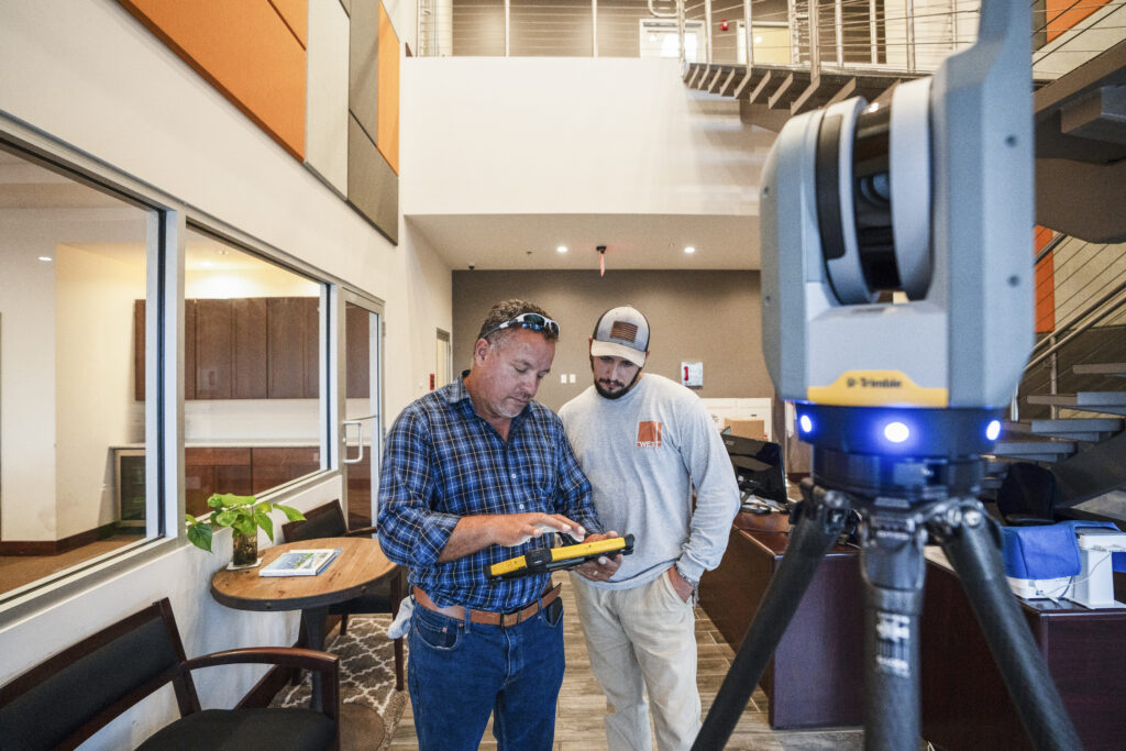
This technology enhances not only the speed and accuracy of our surveys but also the depth of the data we provide. We can deliver detailed 3D models, point clouds, and visualizations that are invaluable for project planning, design, and analysis. These models can be viewed from any angle, scaled, and manipulated, giving you a true-to-life representation of the site that is perfect for both planning and decision-making.
By integrating this technology into our surveying process, we provide a powerful tool for better planning, reduced risk, and more informed decision-making. It is just one of the many ways West ensures projects moves forward smoothly, efficiently, and with unmatched accuracy. Our cutting-edge 3D scanning technology is what truly sets us apart in the field of surveying. This advanced tool allows us to capture highly detailed, accurate, and three-dimensional representations of your site, providing a level of precision that traditional surveying methods cannot match.